Two students in library

CHE University Ranking

Geoscience, Department

Fachrichtung Geodäsie und Geoinformatik

HafenCity Universität Hamburg

Fachrichtung Geodäsie und Geoinformatik
Henning-Voscherau-Platz 1
D-20457 Hamburg
https://www.hcu-hamburg.de
HCU Hamburg
Department on the internet
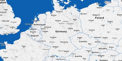
Map of Germany

Activate DAAD map

To activate the map, click on the "Show map" button. We would like to point out that data will be transmitted to OpenStreetMap after activation. You can find out more in our privacy policy. You can revoke your consent to the transmission of data at any time.

Map material from the free geographic information system OpenStreetMap. The DAAD explicitly does not adopt the information provided there (names, boundaries, etc.) in every case. No guarantee is given for the accuracy of this information.

Legend:

  • Department

Basic information

Total number of students at the department

290

Number of master degree students (w/o teacher qualification)

190

Percentage of teaching by practitioners

no data

Percentage of teaching by practitioners, master's

no data

Teaching in core subjects

  • Geology: 0%
  • Environmental and Applied Geosciences: 0%
  • Resource Geology: 0%
  • Mineralogy, Geomaterial Research: 0%
  • Paleontology, Earth and Climate History: 0%
  • Geophysics: 100%

Support during the study entry phase

Total score for support in the study entry phase

13/16 points

Job market- and career-orientation

Bachelor theses in cooperation with work environment

no data

Master theses in cooperation with work environment

no data

Research

Publications per academic

0.6

Citations per publication

3.2

Third party funds per academic

71,600 €

Doctorates per professor

0.1

Research reputation

no data

Not specified

Students' assessments on undergraduate, presence-learning-courses

Teacher support
Support in studies
Courses offered
Study organisation
Exam organisation
Digital teaching elements
Laboratory internships

Not specified
Excursions
Research orientation

Introduction to scientific work
Offers for career orientation
Practical orientation in teaching
Support for stays abroad

Not specified
Rooms
Library
IT-infrastructure
Overall study situation
Return rate of the questionnaires

17

Further information provided by the department

Special features regarding teaching in the bachelor's degree programme

The teaching is supplemented by practical measurement exercises, illustrative exercises in the laboratories and measurement excursions with the HCU's own boat DVocean.

Special features regarding teaching in the master's programmes

The teaching is supplemented by practical measurement exercises, illustrative exercises in the laboratories and measurement excursions with the HCU's own surveying vessel DVocean.

Special features regarding the international orientation

With "Hydrography", Geodesy and Geoinformatics has an English-language, internationally orientated specialisation. It has a special qualification that is– unique in Germany: The programme has been internationally certified according to the "Standards of Competence of Hydrographic Surveyors" in category A (the highest level).

Exchange universities for stay abroads

ETH Zürich, Schweiz; KTH Royal Institute of Technology, Schweden; Polytechnic University of Madrid, Spanien; Valencia Polytechnic University, Spanien; Ghent University, Belgien; Utrecht University, Niederlande; Norwegian University of Science and Technology (Trondheim), Norwegen; Technische Universität Graz, Österreich; Technische Universität Wien, Österreich; University of Gävle, Schweden

Special features regarding the equipment

The HCU's boat DVocean is a fully equipped survey vessel with numerous hydrographic sensors which is regularly used for teaching and research. The measurement exercises are taught in small groups of 4–6 people and, therefore, have a high learning effect. An individually prepared environment on the boat supports professional researchers who are engaged in challenging questions. In addition, the HCU has a fully equipped modern geodetic laboratory and computer pools with special software.

Special features regarding research activities

Geodesy and geoinformatics has a broad range of research topics, is part of numerous cooperations and is a member of the usual specialist networks. In addition, management positions are held in national and international networks: DGfK, GDU, IAG, GVW, DGPF. Participation in collaborative research projects such as the DFG, CRC, SPP and FOR is also taking place and there is a long-standing ESA cooperation.

Other special features

The AStA regularly organises Diversity Days.

Further information on research activities

Further information about study entry phase

Information on access restrictions

https://www.hcu-hamburg.de/sv/fuer-studieninteressierte

Website of the Student Council

online-application

Legend

Groups

green

top group

yellow

middle group

red

bottom group
Not specified
not specified

Acronyms

(S) = Students' judgements

(F) = Facts

(P) = Professors' judgements

Units

Value in percent

Value in points

Euro

Thousand Euro

Last Update 2024: Data collected by the CHE Center for Higher Education
DAAD - Deutscher Akademischer Austauschdienst - German Academic Exchange Service